People who use Google Earth or Satellite mode in Maps are in for a treat as Google has announced today that they are now rolling out the seamless and sharp imagery from Landsat 8 with new processing techniques for much sharper images.
It’s been three years since Google first introduced the cloud-free imagery. It requires mining data from large number of images and then reconstructing a cloud free image, even from the tropical regions.
Landsat 8 captures images with greater detail, truer colors, and at an unprecedented frequency—capturing twice as many images as Landsat 7 does every day.
Google explains that it takes data mining from nearly a “petabyte” of Landsat imagery to choose best cloud-free pixels. That’s more than 700 trillion individual pixels.
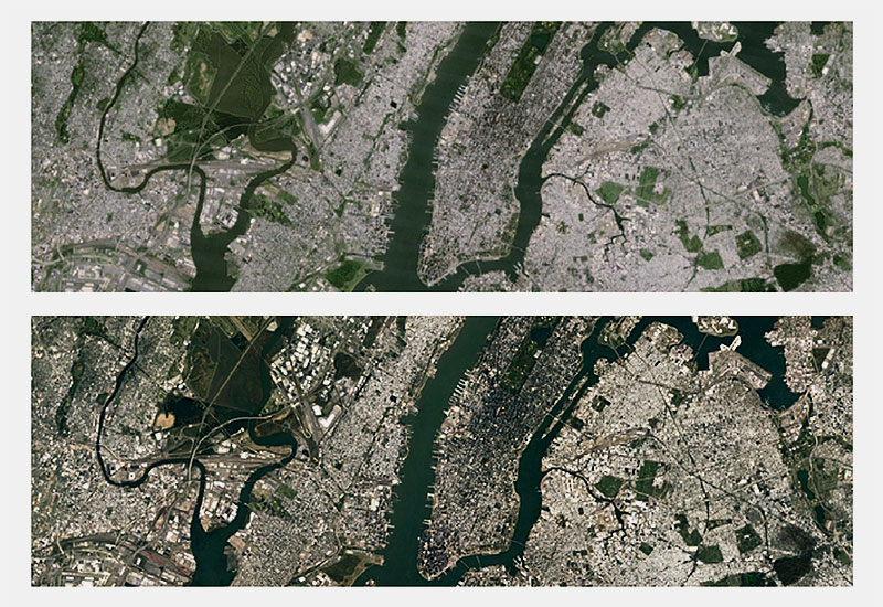
To put that much data into perspective, it’s more than 700 trillion individual pixels. 7,000 times more pixels than the estimated number of stars in the Milky Way Galaxy & roughly 70 times more pixels than the estimated number of galaxies in the Universe.
The new imagery is now available across all mapping products from Google. To check it out, open up Google Earth, or turn on the satellite layer in Google Maps.